The first ten minutes at a trailhead have their own rhythm. Boots get laced, snacks get rearranged, someone discovers the water bottle still sitting on the kitchen counter. In the middle of that small theatre, navigation is usually the first thing waved through: the map is in the pack somewhere, the phone has a line on it, and the sky looks agreeable enough. Most navigation trouble on day hikes does not begin three kilometres up the trail. It begins in the car park, with a plan nobody quite checked.
What follows is the routine worth borrowing. It takes about five minutes, needs no special talent, and catches the errors that are expensive to fix once you are above the trees.
1. A Map You Can Read Without a Screen
Start with paper. A folded sheet does not need a charge, works in gloves, and shows the whole shape of the ground at once. For day hikes, a scale of 1:25,000 gives you the detail to follow a vague path through forest; 1:50,000 is fine for open country and long ridges. Check the contour interval before you trust your reading of a slope—twenty metres versus ten metres changes how steep a climb looks.
Confirm the edition covers current trail alignments and that the sheet actually includes your trailhead. Plenty of walks begin at the very edge of a map, which is exactly where people lose the first kilometre. Fold the map to the relevant section, put it in a clear case, and keep it in a side pocket or hipbelt rather than the bottom of the pack. A route line drawn on a blank background is not a map; it tells you where to go and nothing about what happens if you cannot.
2. Compass, Declination, and One Confirming Bearing
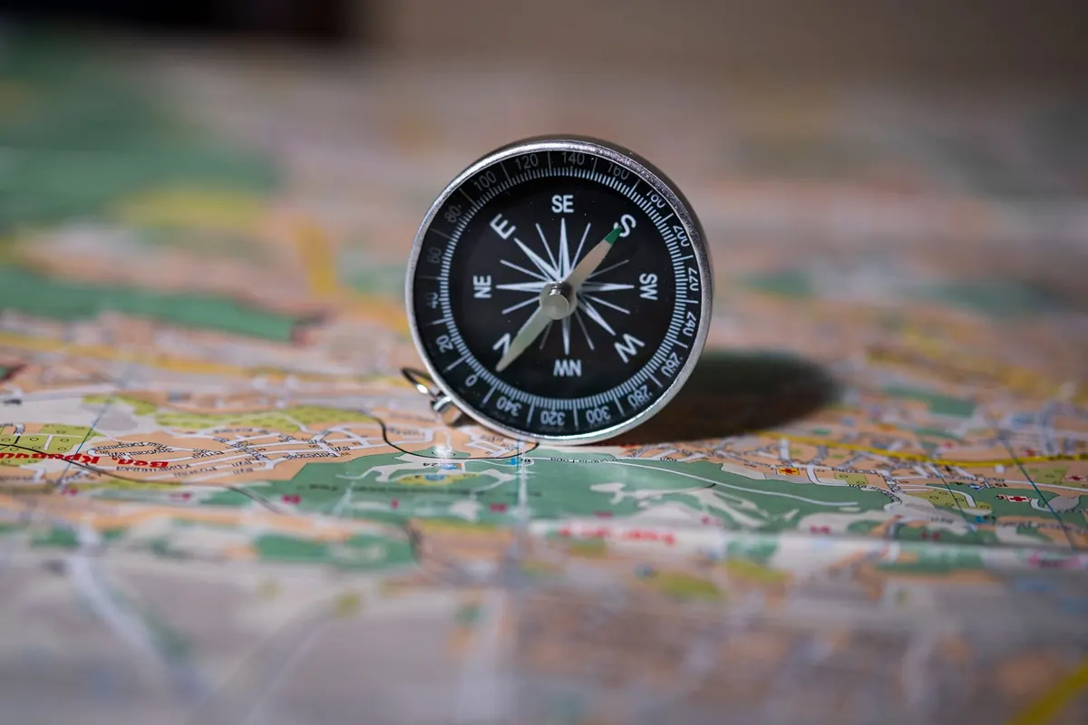
Any baseplate compass will do the job; what matters is that you have set the local magnetic declination, or at least written it in the map margin where you will see it. Declination shifts slowly over years, so check a current figure rather than a number remembered from a decade-old guidebook. If your compass has an adjustable declination scale, set it once and forget it. If it does not, remember whether you add or subtract when converting between map and ground.
Then use it, briefly, at the car. Take a bearing to a landmark you can see, or follow the first trail junction on the map and note which direction it heads. Thirty seconds of practice is the difference between a tool and a lucky charm in the pack.
3. Backups That Work When the Signal Does Not
Phone navigation is genuinely useful and genuinely fragile. Cold drains batteries faster than people expect, screens dim in sun, and a dropped handset ends the conversation. Treat the phone as a helpful second opinion rather than the plan itself.
Download the map area at home—not just the route line—and test it in airplane mode before you leave. Then run through a short check at the car:
- Offline map downloaded for the whole walk, with a margin around it
- Phone in airplane mode or low-power mode, kept somewhere warm rather than on an outside pocket
- Power bank charged and the correct cable in the bag
- Spare batteries that match your headlamp or GPS unit
- A photocopy of the route notes in a pocket, folded small
A GPS watch or altimeter is a fine cross-check on distance and elevation gain, but it will not tell you which fork to take. Paper remains the fallback that fails least.
4. Weather, Daylight, and a Turnaround Time
Check the forecast for the elevation you will actually reach, not the town you parked in. Valleys and summits can differ by a jacket and then some, and afternoon thunder carries more weight on a ridge than in a village square. Look at wind, cloud base, and the trend across the day rather than a single icon.
Next, sunset. Write down the time, subtract an hour for the slower pace of tired legs and the chance of a wrong turn, and you have your latest sensible return. From that, set a turnaround time—the hour at which you turn around regardless of how close the summit looks. Write it on the map. A number on paper outranks a good intention in your head.
5. Route Notes, Bailouts, and Who Knows Where You Are
Route notes do not need to be elegant. A dozen lines, written by hand, covering the junctions and the places where the path thins out, will carry you through the moment when confidence wobbles. Include the intended direction at each fork, any stream crossing, and the landmark that tells you the descent has begun.
Bailout points matter as much. Note where a side trail, forest road, or short ridge leads back toward the car, and roughly how long that escape costs. On the way up, glance at these junctions so you recognise them in reverse.
Finally, tell someone. Leave the car, the trailhead, the route, and a return time with a person who will actually notice. Add a note on the dashboard if it helps, and send a message when you are back at the vehicle.
The Ten-Point Check Before You Lock the Car
- Paper map of the exact area, folded, cased, and within reach.
- Compass with declination set, plus one bearing taken to prove it works.
- Route notes with junctions, directions, and water crossings noted.
- Offline map downloaded and tested with the phone in airplane mode.
- Power bank and cable charged, with spare batteries for anything else.
- Forecast checked for your high point and your exit time, not the valley town.
- Sunset and turnaround time written on the map in plain sight.
- Bailout points marked, with a rough sense of how long each one takes.
- Headlamp and whistle in the pack, not in the glovebox, in case the day runs long.
- Someone informed—route, trailhead, and expected return already sent.
Five Minutes at the Back of the Car
Do the check standing up, with the map unfolded and the tailgate open. Say the plan out loud: first junction, the ridge, the turnaround, the way back. It feels slightly ridiculous and it works, because the errors surface while they are still cheap. Then mark the time you leave, tuck the map where you can grab it without stopping, and walk.
The aim is not a perfect system. It is a small, repeatable habit that keeps a wrong turn as a wrong turn—ten minutes and a laugh—rather than the start of a long afternoon. Five minutes at the trailhead buys you a day of not wondering.
Photo: Gaelyn Salome / Pexels